I wanna climb that!

Granite Pegmatites
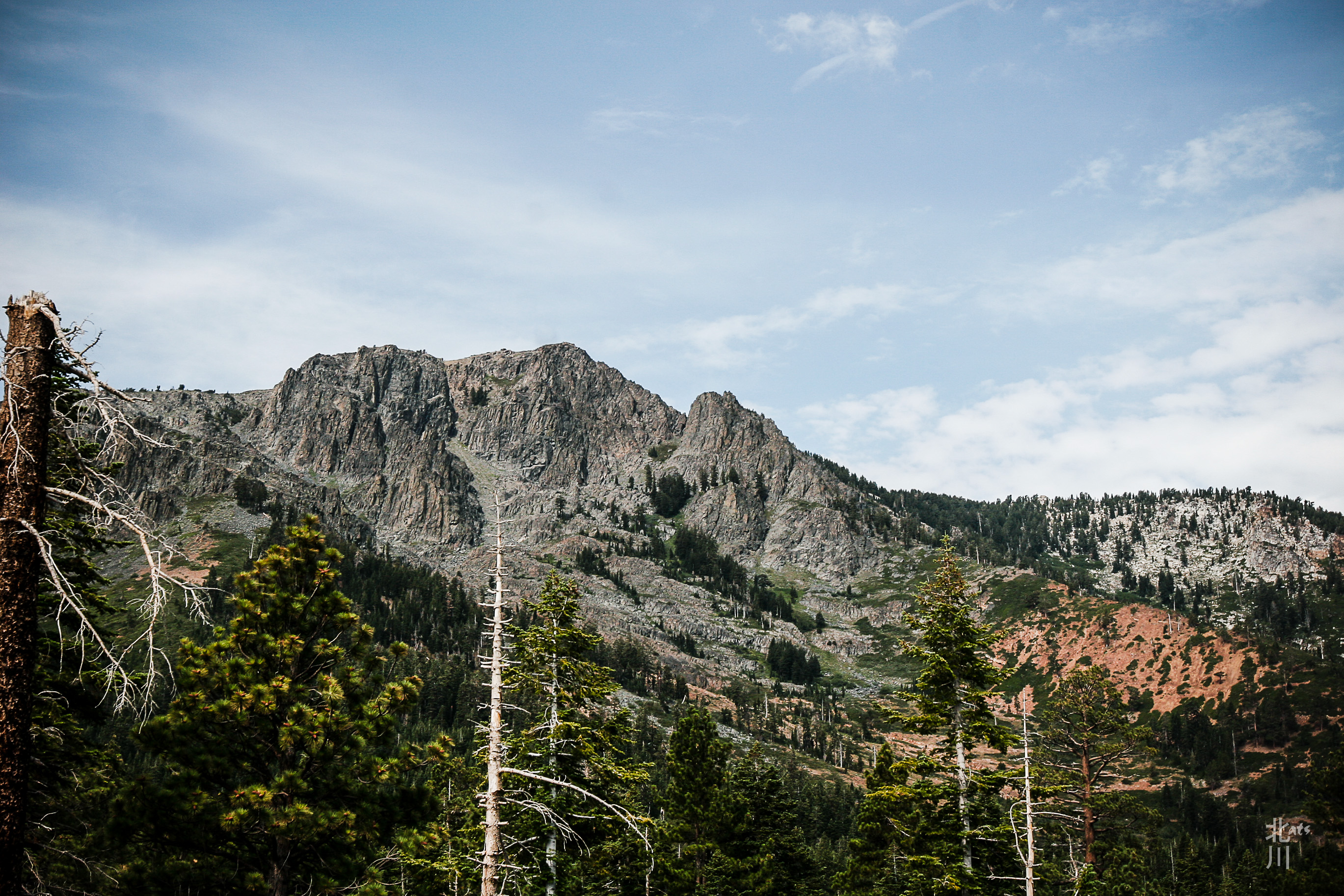
 Walked across this ridge and it was loaded with quartz crystals. You can see the faint veins of white running through the granite. When I got back, I searched the web for “red granite with crystals” and this is what I learned.
What is Pegmatite?
Pegmatites are extreme igneous rocks that form during the final stage of a magma’s crystallization. They are extreme because they contain exceptionally large crystals and they sometimes contain minerals that are rarely found in other types of rocks.
To be called a “pegmatite,” a rock should be composed almost entirely of crystals that are at least one centimeter in diameter. The name “pegmatite” has nothing to do with the mineral composition of the rock.
Most pegmatites have a composition that is similar to granite with abundant quartz, feldspar and mica. These are sometimes called “granite pegmatites” to indicate their mineralogical composition.
PCT South
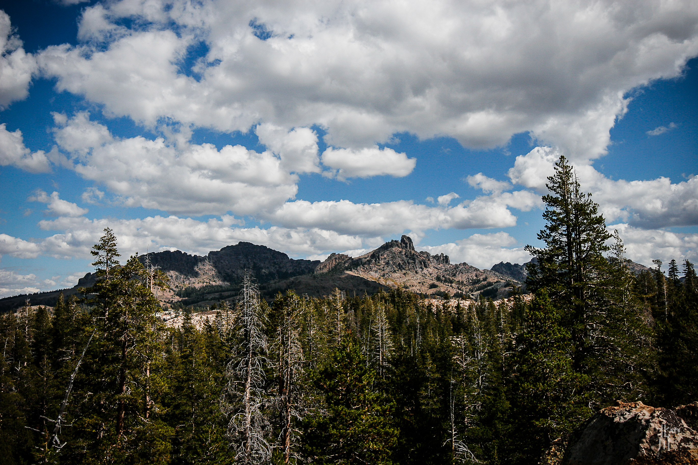 I hiked along the PCT trail about a mile and a half. Found a great spot to view the mountains of the PCT heading South.
PCT North
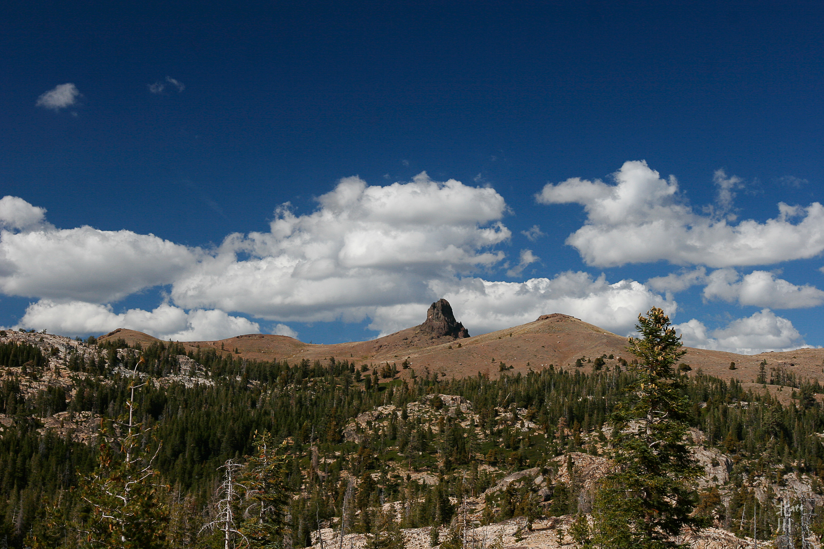 Off of Blue Lakes Road is Tamarack Junction. It is a crossroads for the PCT. North takes you to Carson Pass and South will take you to Ebbetts Pass near Hwy 4.
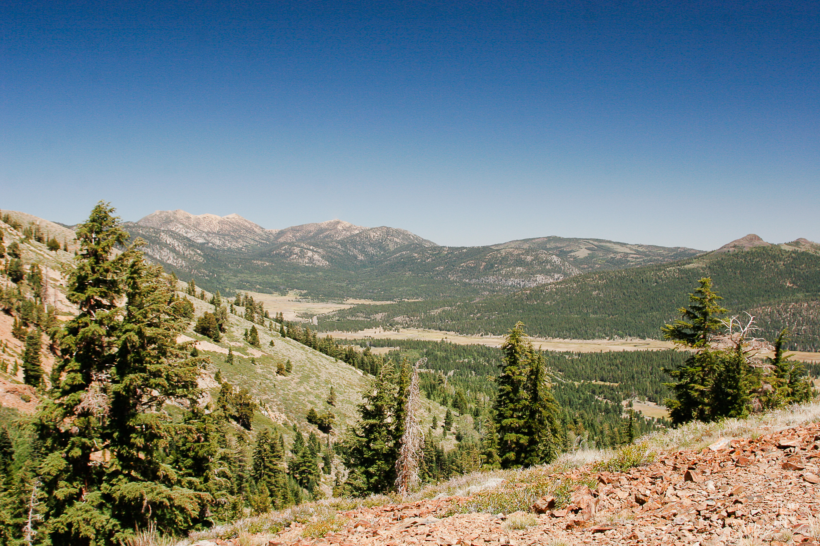
Clear for Miles…
 From this spot, one could see for miles. That’s Hope Valley in the middle right side on the photo. I lucked out on the views on this road. I’ve driven by it so many times, never making the time to stop. My dad use to take us fishing at Blue lakes when we were young. I remember old dusty roads and goofing off along the shoreline. I don’t remember views like this. Time to make new memories and combine them with the old ones.
Blue Lakes Road
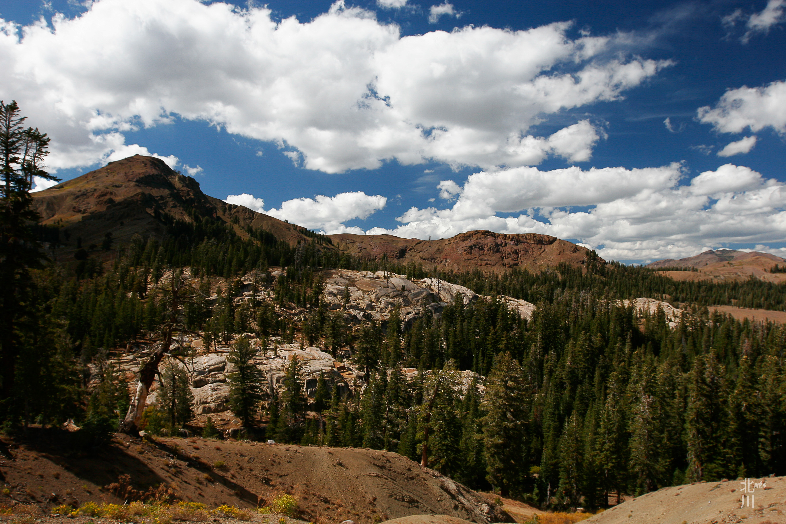 Fun road to travel on with lots of areas that I want to explore. I’ll be back soon!
Freel Peak

Freel Peak (Washo: dewgulum dakʔak[3]) is a mountain located in the Carson Range, a spur of the Sierra Nevada, near Lake Tahoe in California.
The peak is on the boundary between El Dorado County and Alpine County; and the boundary between the Eldorado National Forest and the Humboldt-Toiyabe National Forest.[4] At 10,886 feet (3,318 m) it is the tallest summit in the Carson Range, El Dorado County and the Tahoe Basin.[2] Due to its elevation, most of the precipitation that falls on the mountain is snow.[5]
In 1893, the U.S. Geological Survey assigned the name Freel Peak to what was then known as Jobs Peak. James Freel was an early settler in the area.
Above Hope Valley
 From a ridge near Crater Lake, you can see Hope Valley below. That’s Pickett Peak and Hawkins Peak to the left.
Final Look at Mt. Tallac
 It was our final day of backpacking and this was Mt. Tallac from the ridge trail above Fallen Leaf Lake.
Hello, down there…
 To give you an idea of the trail we came down. I’m above on a switch back taking photos while my sister hikes ahead of me.
