I wanna climb that!
Lean Left
 When you head straight down on a slope like this one, you want to lean left the mountain.
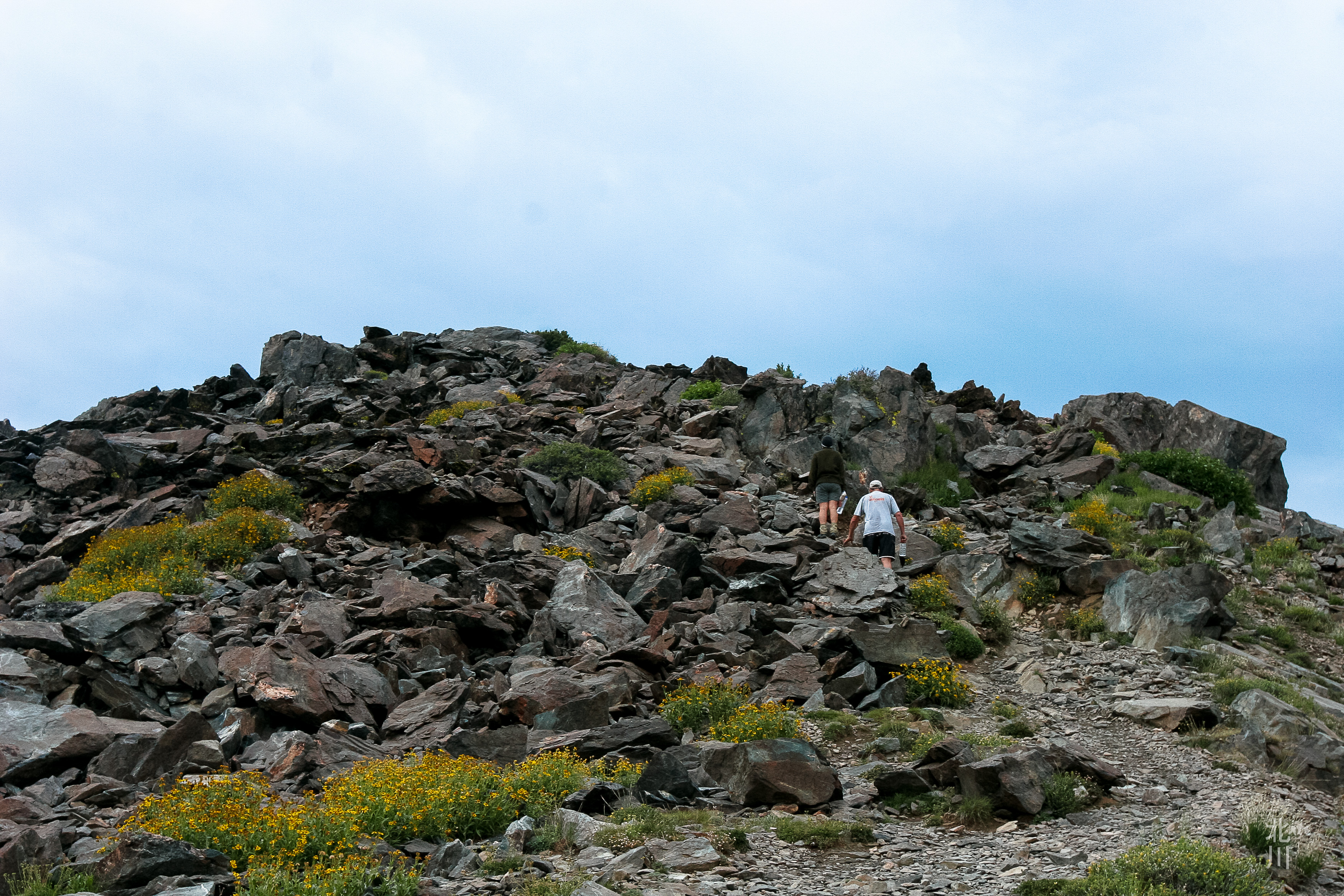
Steep
 From the meadow, the trail leads to this steep grade. It’s mostly granite scree and out in the open. It was a little intimidating at first.
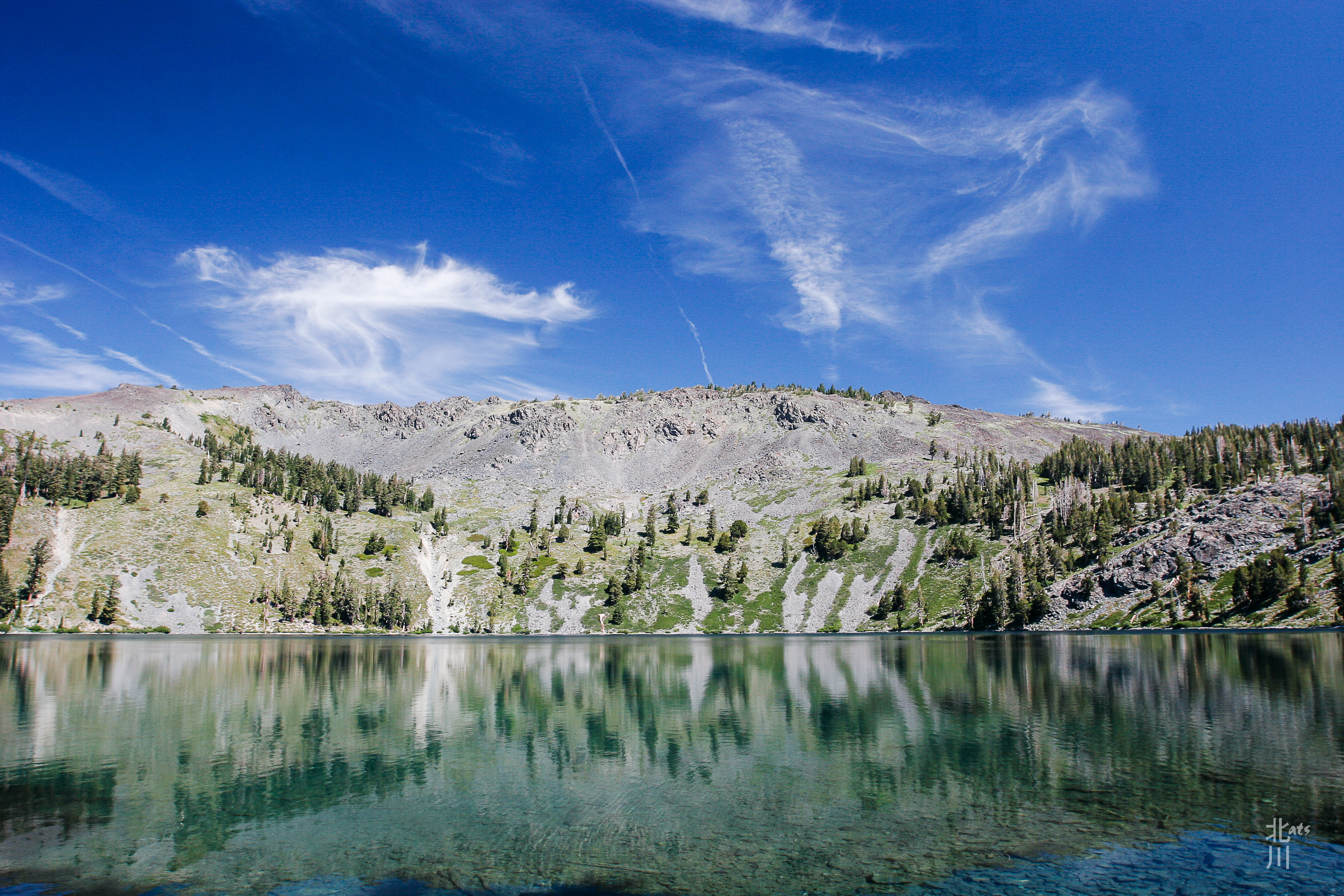
Back of Tallac
 The 4 day backpacking trip was coming to a close. This was a look at the back of Mt. Tallac as we headed down the trail.
Good Morning Lake Tahoe
 This photo was taken around 6:09 AM, we reached the summit and the view was stunning of Lake Tahoe.
Above the Range
 The ascent to the summit of Mt. Tallac is about 1.5 mile from where we camped at Gilmore Lake. As we gained in elevation, it seemed like we were above the mountain ranges. It’s an optical illusion. Pyramid Peak in the distance, is at 9983′ while Mt. Tallac is only 9735′ in elevation.
Gilmore Lake
 Day 3, our campsite for the evening before tackling Mt. Tallac the following morning. Before the thunderstorm came in, I had the chance to relax and explore this popular lake.
Heather Lake and the Crystal Range
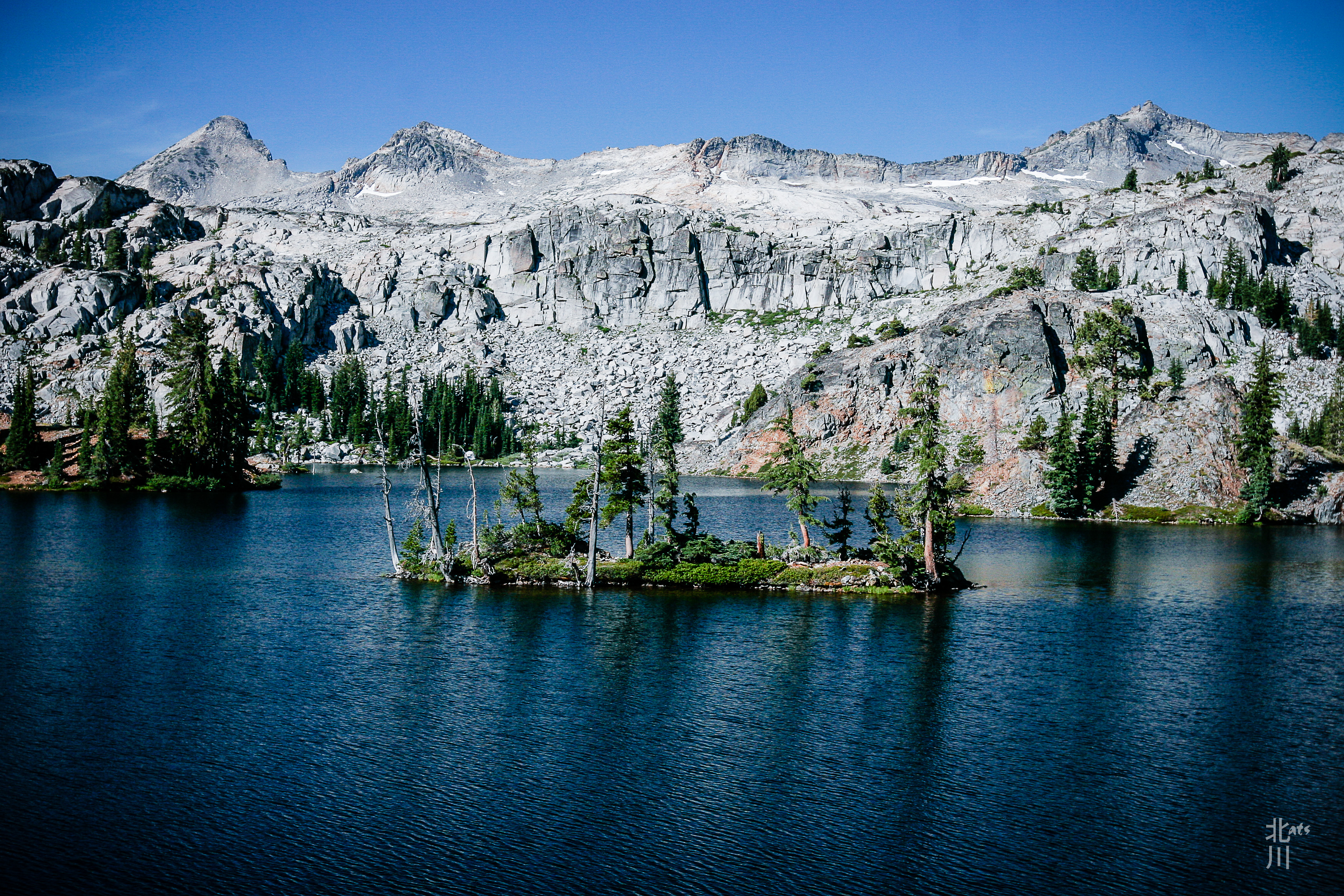 Heather Lake with the iconic island in the middle and the Crystal Range in the background. That’s Pyramid Peak on the left and Mt. Agassiz on the right.
Real? or Reflection?
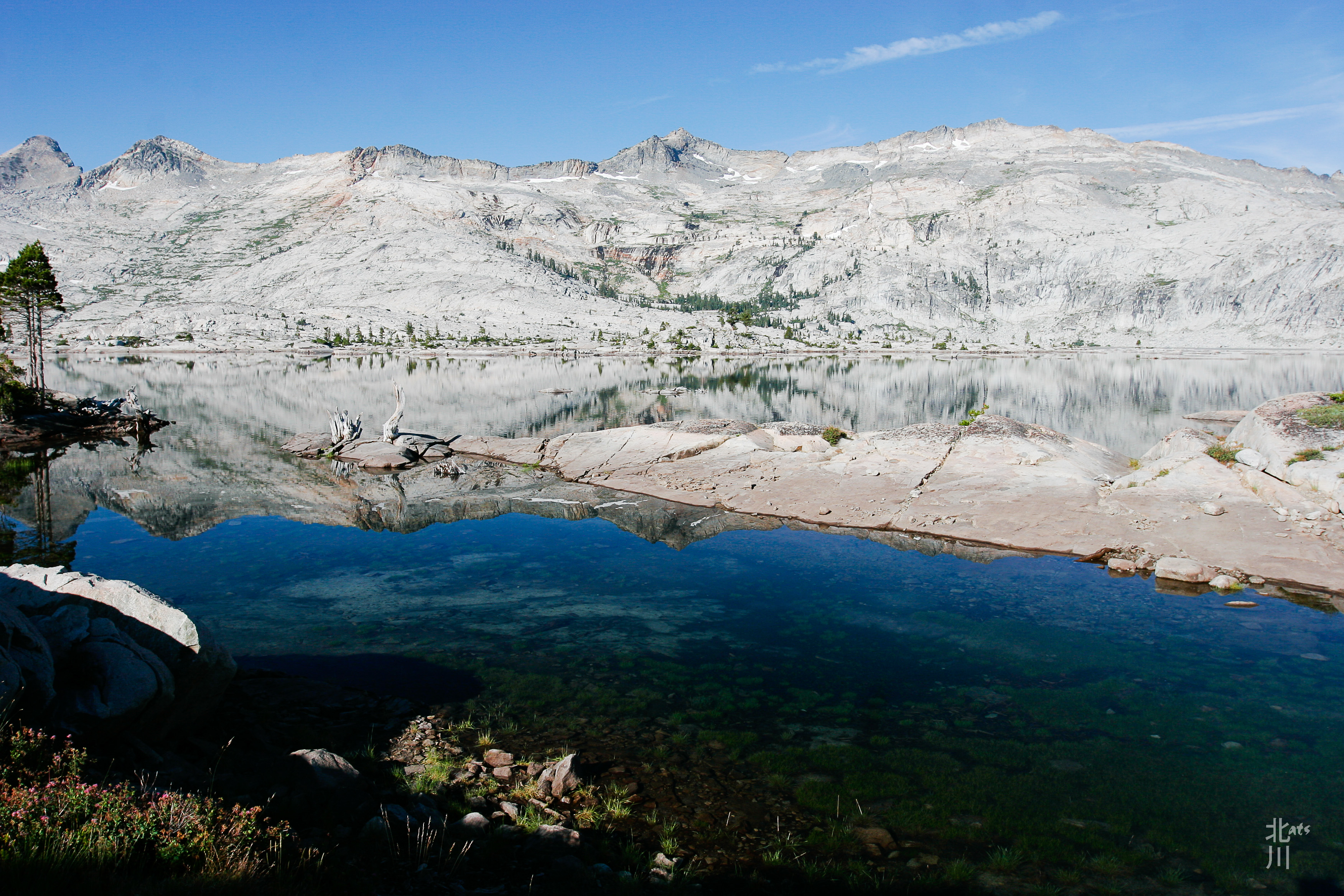 This was a fun shot. It was hard to tell where the reflections ended in the lake. The granite shoreline juts into the water and appears as one with reflection of the Crystal Range.
Lake Aloha II
 Lake Aloha is over 2 miles long and at every turn, there was another great view of the lake and its surroundings.
